Geospatial Services
Accurate Data. Smart Decisions.
We deliver advanced geospatial solutions that empower organizations to collect, analyze and visualize spatial data for better planning, management and governance.

Accurate and
Reliable

Faster Data
Collection

Advanced
Technology

Better Planning &
Decisions
Drone Survey
Capture high-resolution aerial imagery and accurate spatial data using advanced drone technology. Our drone surveys enable rapid mapping, infrastructure assessment, land monitoring, and project planning with greater efficiency, accuracy, and cost-effectiveness.

Door to Door Survey
Conduct comprehensive field surveys for property, asset, demographic, and utility data collection. Our trained survey teams ensure accurate, geo-tagged information that supports planning, governance, taxation, and decision-making processes.

GIS Mapping
Transform spatial data into intelligent digital maps for better planning and management. Our GIS solutions help organizations visualize assets, analyze geographic information, improve resource allocation, and support data-driven decision-making.

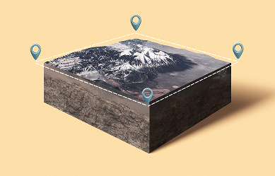
3D Mapping
Create detailed three-dimensional representations of terrain, infrastructure, and urban environments. Our 3D mapping solutions provide enhanced visualization, planning capabilities, and accurate spatial insights for development and infrastructure projects.
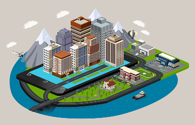
3D Twin Model
Develop dynamic digital replicas of physical assets,
buildings, and urban
environments. Digital Twin technology enables real-time monitoring, predictive analysis,
improved
asset
management, and smarter infrastructure planning.
Property Tax Assessment Survey
Deliver accurate property identification, measurement, classification, and valuation through GIS-enabled surveys. Our solutions help urban local bodies improve tax coverage, increase revenue generation, ensure transparency, and strengthen municipal governance.
 High Accuracy & Reliability